In August I did a road trip with my dad for his 60th birthday. We'd been planning it for a number of years and the main focus of the trip was to go to Bonneville Speed Week. With the whole of the US at our fingertips it would have been a shame to not be able to do a few other car things during the trip, so we'd been looking for other events +/- a week either side of Speed Week in the neighbouring states. There seemed to be nothing; no NHRA drag racing, no Nascar, not even any football or anything that was worth travelling for. We found the Kentucky Street Rod Nationals the weekend before, which is one of the biggest shows in the US and dad is really into street rods, so we decided that would be the beginning of the trip and we just had to link the two and fill the week in between. We decided to fly into Chicago and pick up a car, drive down to Louisville, Kentucky which is about 500 miles, then work our way back up to Chicago in our own time with no rigid plans, spend a couple of days in Chicago before flying out to Salt Lake City. We'd looked at a number of options and we knew Route 66 ran up through the state of Illinois, but this would mean a 300 mile detour over to St Louis in the state of Missouri to pick it up. We decided to do it! So this write-up is the Route 66 part of our trip which turned out to be the most amazing road trip I've ever done!
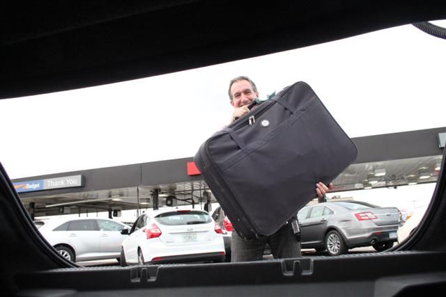
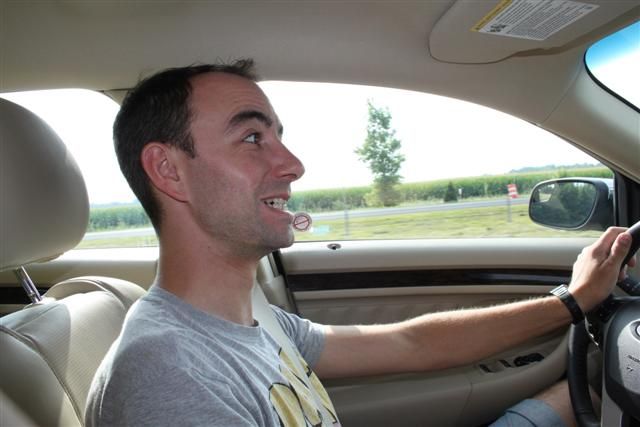
We decided early on because of the mileage we'd be covering that we should have a sensible car, so no mad Mustangs to report unfortunately. We got a brand new Ford Taurus with 3 litre V6 but I tell you it shifted that barge quite effectively and returned us an amazing 30 mpg in US gallons. The boot was enormous. Here's me in it having my suitcase passed to me:
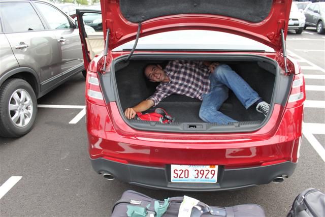
Nah, only joking. I don't always look that silly
Monday 5th August:
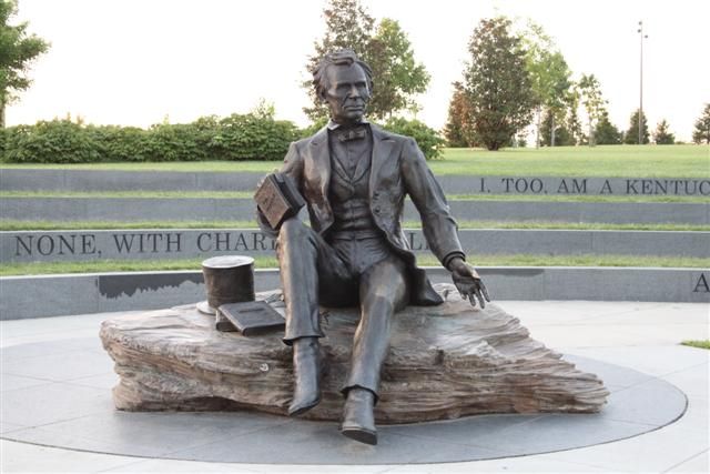
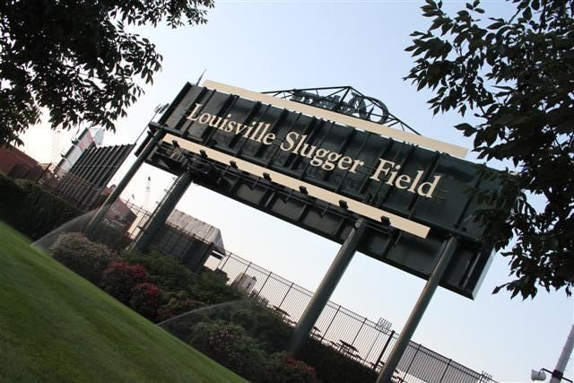
So we started our journey in Louisville, Kentucky. It's the largest city in Kentucky and situated on the Ohio River. It's famous for Abe Lincoln and the Slugger Field, plus of course the Kentucky Derby which takes place where the Nationals were held.
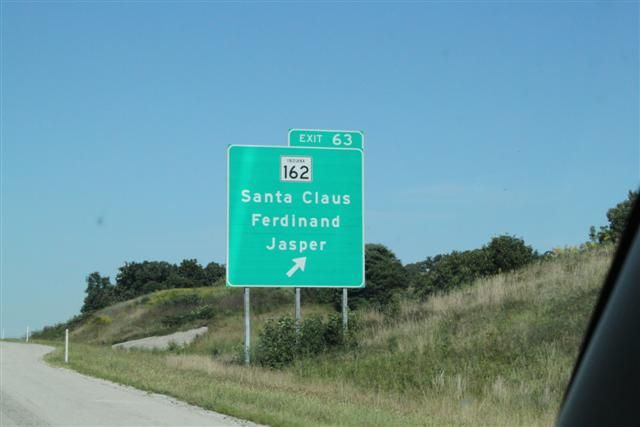
From Louisville we drove pretty much due west across to St Louis in Missouri where we could pick up where the old Route 66 road left the state of Illinois and we'd follow it 'backwards' through Illinois up to Chicago. I say backwards, because the road was built from East to West to take people from the poverty stricken East to the more prosperous West of the US. Along the way we spotted a sign to Santa Claus - it didn't matter how far away that place was - it had to be visited
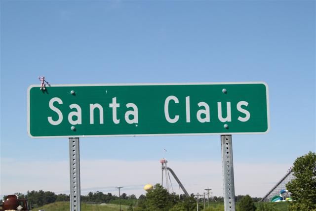
Woohoo!
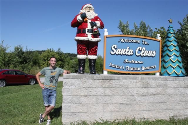
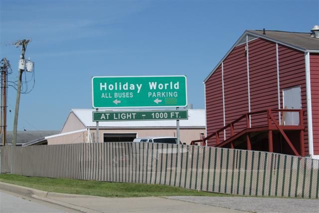
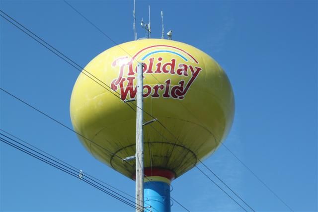
It turned out to be a whole town that was devoted to the Santa Claus theme park and Holiday World. Hey kids, we're HERE!
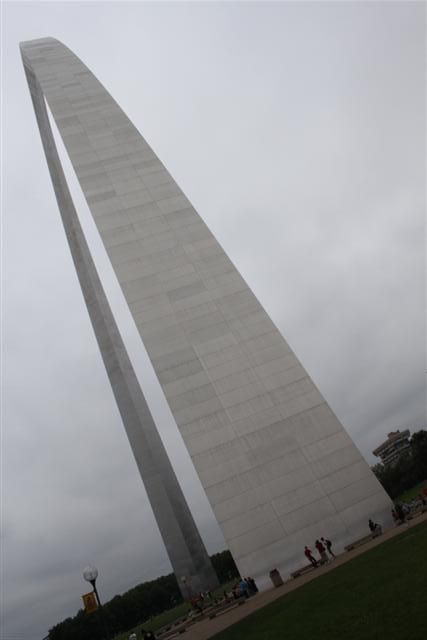
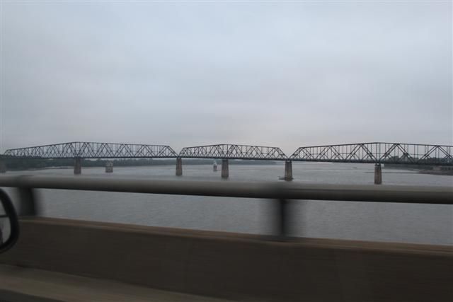
At St. Louis, we visited and went up the Gateway Arch, a 192 metre welded stainless steel arch that marks the gateway to the West.
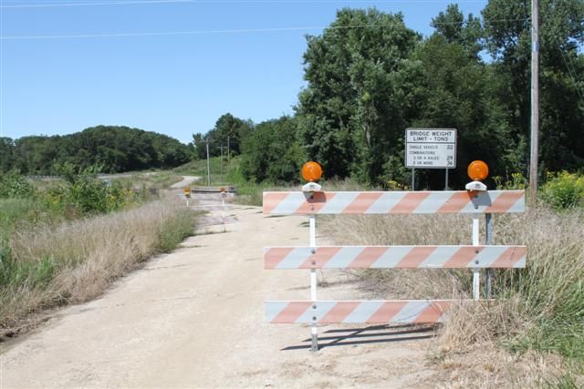
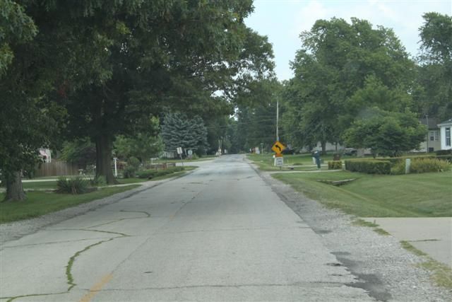
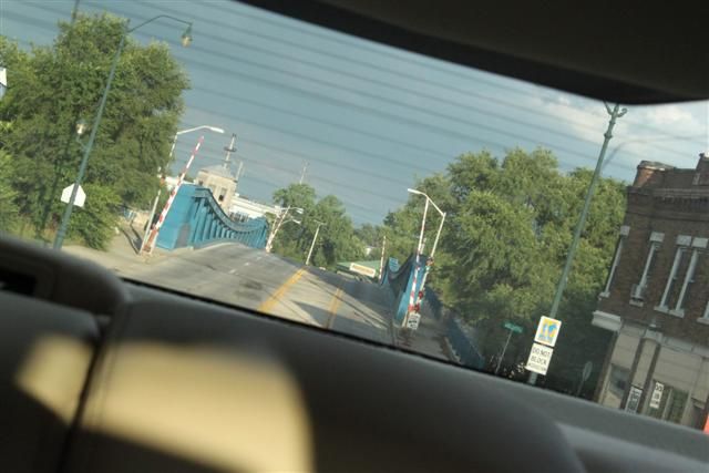
This is very close to where the old Route 66 road crosses the Mississippi river so the main focus of our roadtrip was about to begin and we were excited. Having climbed the arch we had a very basic map to find Route 66. We were looking for the Chain of Rocks Bridge which is an abandoned steel road bridge that was built in 1929 and crosses the Mississippi linking Missouri with Illinois. Taking the main road close to the river and heading north, which was correct, we soon found ourselves heading in the wrong direction and exactly where we DIDN'T want to be: we ended up a long way into an all-black neighbourhood. I never appreciated how segregated America is until quite recently, but blacks and whites still live very much apart and there are still huge social differences between 'white' and 'black' areas. Black areas being very poor and run-down and bordering white areas being affluent. The whole area was falling down and I was later told that many of these buildings that appeared to be abandoned were in fact still inhabited by the poor. It was very distressing to see this and I can only blame the lack of any kind of social system to pick people up when they fall down.
Essentially, we had been going in the right direction but drifted off course a bit, lost the river and gone too far. We turned around in the middle of a scene out of Boys in the Hood and headed back towards the water. Eventually we found a road that was on our map and we knew again where we were and headed that way. And this is what we found. First this:
THEN THIS!
We'd made it, WE WERE ACTUALLY ON ROUTE 66!!!
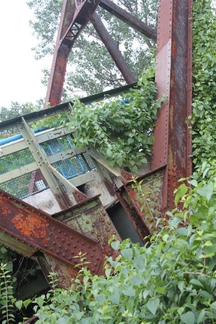
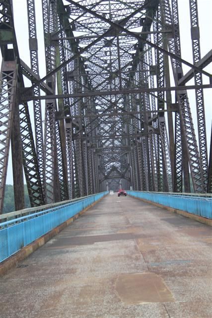
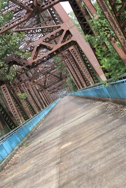
This part of the road was actually just part of the normal roads and had been built over so it wasn't very exciting but we were both whooping and the excitement was brewing. The bit we were looking for was a mile or so ahead and, although we knew it was an abandoned bridge, we didn't really know what we were looking for. There was no question when we got there:

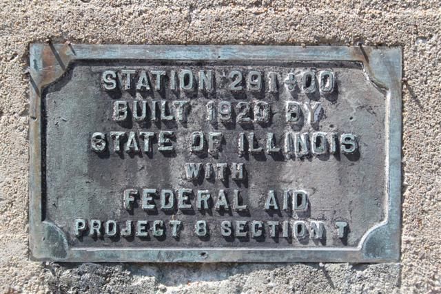
Read more about the bridge here, but essentially the Chain of Rocks Bridge was built in 1929 for Route 66 traffic to cross the Mississippi. It's 1.6 miles long with a bend in the middle and was officially closed in 1970. It remained abandoned for many years until the late 90's when a trail group renovated the path and re-opened it for foot and cycle traffic, so today you can walk across the bridge. It's still very much crusty and unrestored, there's hardly anyone there, very quiet as you approach it and you have to watch your feet in places. It's awesome!
Nearer the middle, some Route 66 regalia has been placed there:
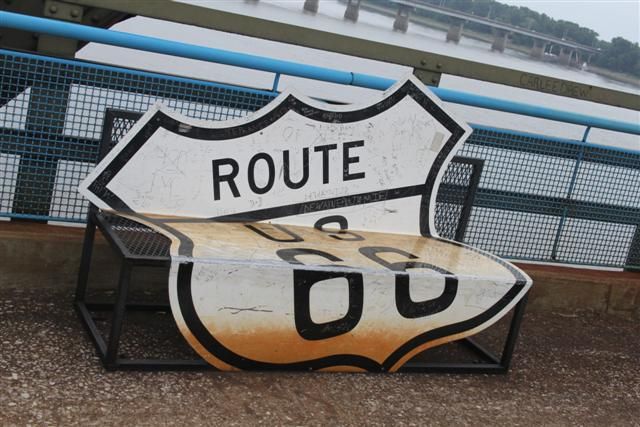
It pretty much all looked like genuine stuff and it felt good to be there. Not overdone. Further along as we walked around the bend, we were surprised to see this in the distance:
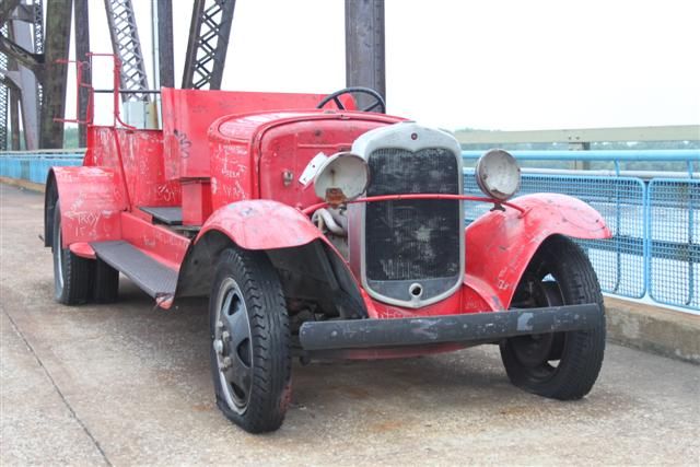
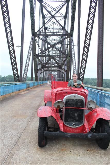
Couldn't see what it was at first but it looked like a 30's car:
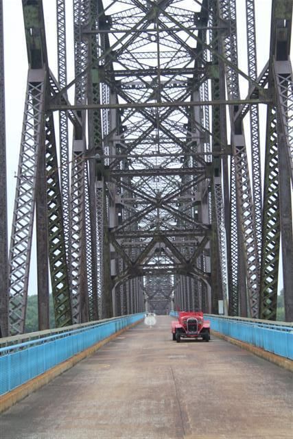
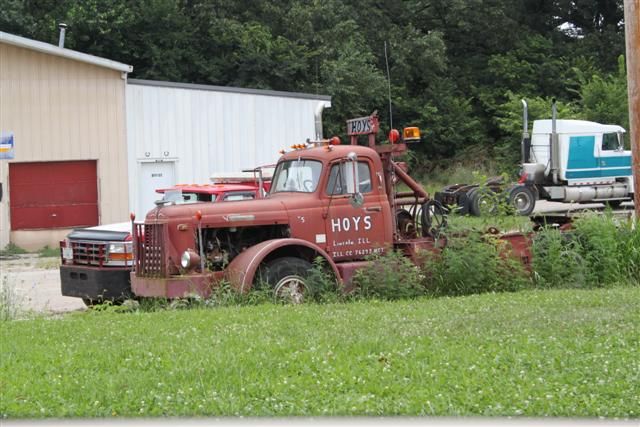
It's a 30's fire truck left as a monument. Some might see it as a waste left there to rot and get vandalised, but it was pretty much limited to names and messages in the paint. I thought it was great:
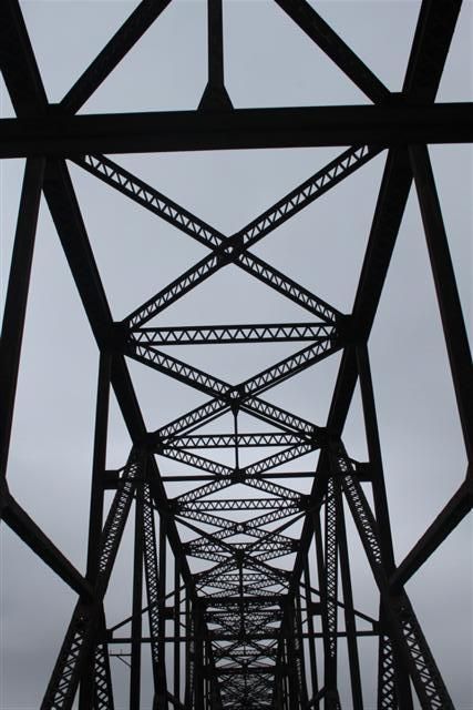
It was getting on a bit and we needed to get to the Illinois side of the river to find a motel for the night. Because Chain of Rocks is not open to vehicles, we had to drive along the river and pick up 270 to use the new bridge. It's not far down and here is Chain of Rocks from the side:
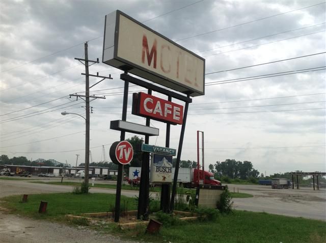
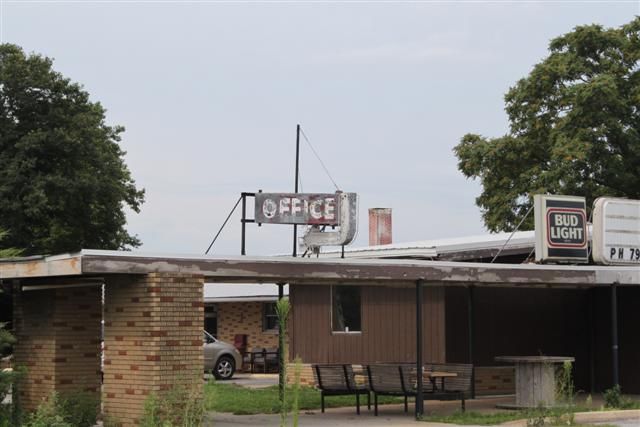
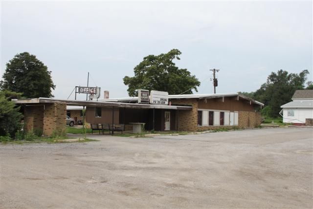
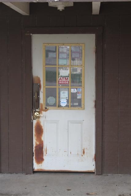
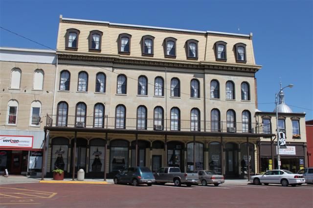
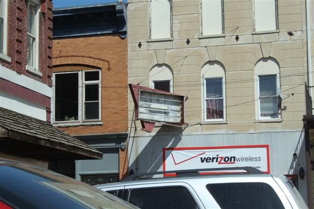
Ideally we wanted a motel somewhere near R66. Our guide sheet said it was run down in that area but nothing could have prepared us for what we found. We were in an area called Granite City which, when R66 was built, began to prosper. As R66 was abandoned and closed, many of the towns along it began to perish and Granite City was one of them. Today it is nothing more than a truck stop with a few diners, but the relics of R66's heyday are still there: huge numbers of old signs next to the road and abandoned motels. Or that's what we thought. Turns out most of these places have people living in them and are still open - not that they see a lot of passing trade. We decided to check one out. As we went in it was 100% Cohen Brothers film. Crusty smashed out Googie 'Motel' sign, some residents sitting on wooden chairs outside motel rooms, a small child playing with a ball in the stones, a thin looking dog barking, a slight breeze, a kitten ran out of nowhere and disappeared. I jest ye not, this happened! So we asked one of the people if there was a room free and they said they'd get the owner. He could have just walked round and talked to us in the open, but he made us go in and talk through the window, which was a curved top window with a hole in it in a small hatch. He pulled a blind up and spoke to us through the hole!
They were full and it was getting dark so we tried the next one across the crossroads. They had a room for $48 so we checked in and asked one of the residents where we could get some food. There were 6 residents outside and a young girl doing here homework. The whole place was completely run down, but the inside of the room was actually pretty nice, it was clean and had a good shower. We ended up at Hardees, a local burger diner. So I ought to point out that we couldn't look any more conspicuous. Two Brits in a brand new car in a rund down part of town where nobody ever visits because the R66 advice says stay away from the place. When we ordered in Hardees they could tell immediately and asked where we were from. When I said we were from London the girl replied "LONDON? What the F*** are you doin' in Granite City?" which was hilarious. On the way back we stopped at the Mart to get some beers in the hope that we might spend some time talking to the motel residents. Of all the beers they could keep, we found Newcastle Brown Ale and it was a damn sight cheaper than it is over here - $7.99 for 6! So we scooped up a crate to share. So the first guy John, he was an ex felon and out of work but doing cash-in-hand work to pay the motel rent. He lived with his girlfriend and 11 year old son in the motel room. She asked us if we smoked marijuana. There was another guy who had 3 dogs, peagles he called them, half pitbull / half beagle and they were great. I was telling the kid all about England, he said he wanted to be a police officer when he grew up and I gave him a £1 coin as a souvenir. Late in the evening we were speaking to a big guy who worked at a car dismantler and we were comparing scrappage laws. He said that John and his girlfriend met a few weeks ago in a mental asylum.
Tuesday 6th August:
Early the next morning we got breakfast at the local Waffle House and took some pics of the motel:
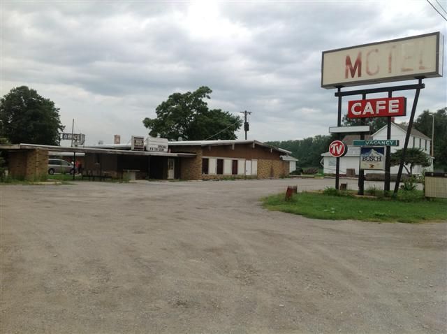
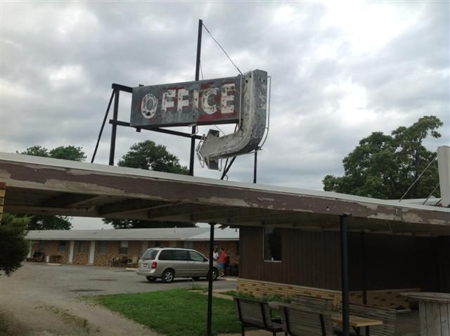
We got talking to the owner of the motel, Nick Patel, who brought out an old aerial shot of the motel which showed it when it was still complete:
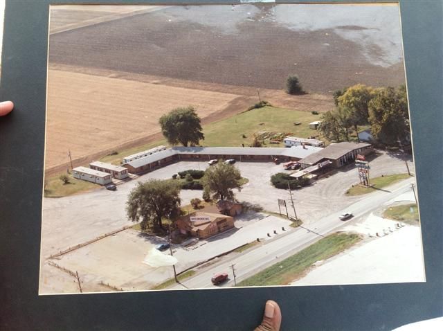
Much of the building has been removed now due to planning laws and general lack of business. Another factor that led to the local demise was a change in alcohol licensing laws to try to clean the place up, so the motel can no longer have a bar and the local bars and nightclubs closed as a result. He paid $225k for it a couple of years ago and is hoping a local casino firm will get planning permission to build a casino on the site which will bring huge amounts of money back to the area. It's quite likely, so these sorts of motels will not be there for much longer. If you get the chance to go there, it's the Canal Motel on the Chain of Rocks Road, Granite City, Illinois. Chain of Rocks Road is actually Route 66.
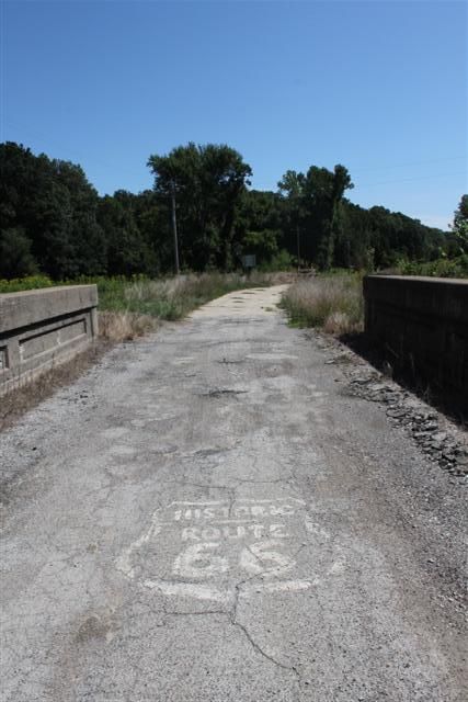
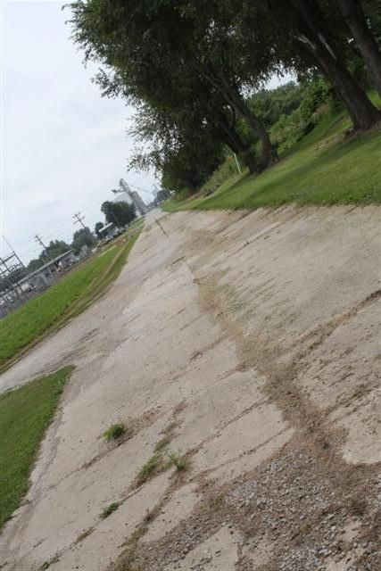
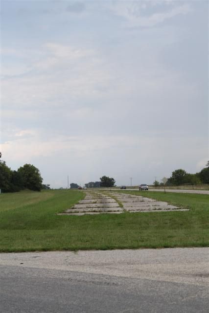
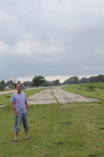
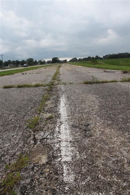
We wanted to see the Chain of Rocks from the Illinois side and make it the beginning of our journey, so we took a drive down the road to it. On the Missouri side of the bridge there was an old busted up road surface leading up to the bridge which I commented that it looked like it might be original. This was a similar surface and led directly to the bridge so we were fairly confident we were now driving on an original Route 66 surface:
The bridge runs through some forestry, it's a bit more crusty and it's a lot quieter on this side because it's not near a main road, so the abandoned feel about it is much stronger:
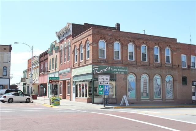
We could see on our guide sheet that Route 66 wasn't just one road. The original road picked up many existing towns and road features like existing bridges and it was rebuilt several times in the period between 1926 and 1977 with bypasses and new towns. It therefore took a number of different routes over the years. The guide sheet told us to head off slightly east and pick up the 270 road again and drive on for a number of miles to pick up R66. Clearly, the original road wouldn't have done this because we were standing on it and it would have just gone straight, so we opted to go that way. We passed the motel, an abandoned liquor store and the first of what we'd see of various buildings with old signs still hanging out the front:

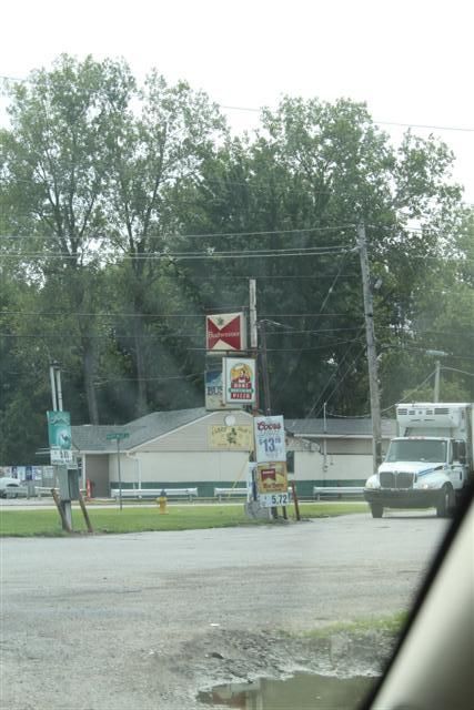
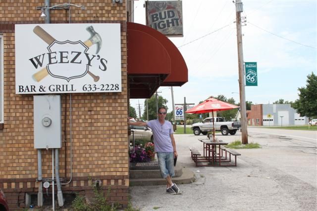
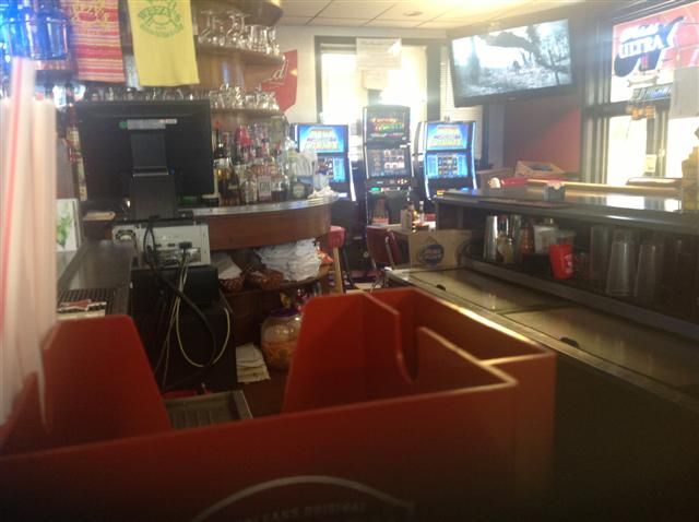
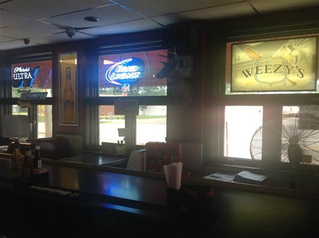
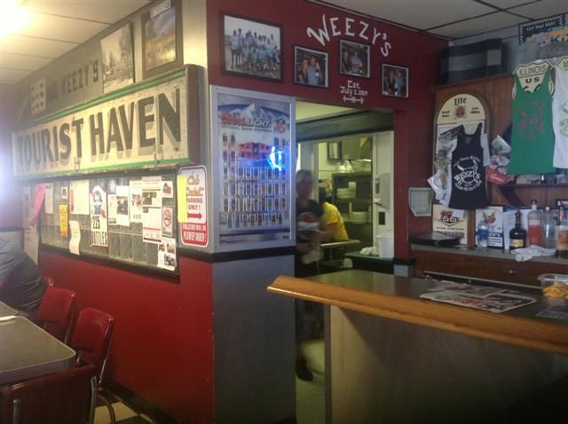
We continued for quite some distance before we picked up a place called Edwardsville that was on the guide sheet and eventually a place called Hamel where Weezy's was listed as an original Route 66 diner. We stopped off for a couple of coffees and a sandwich before heading on:
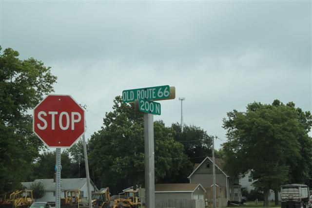
Now we were starting to see more of the brown Historic Route 66 signs that are dotted along the route:
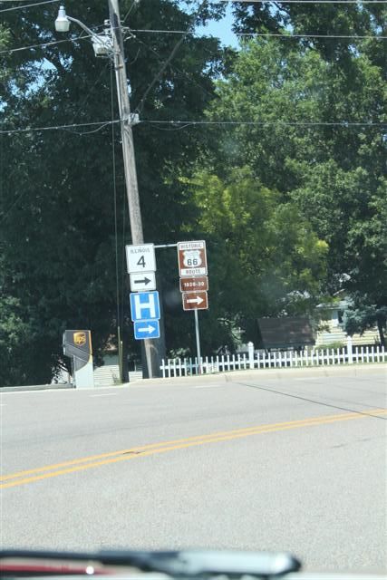
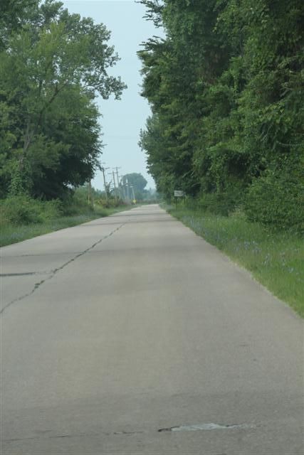
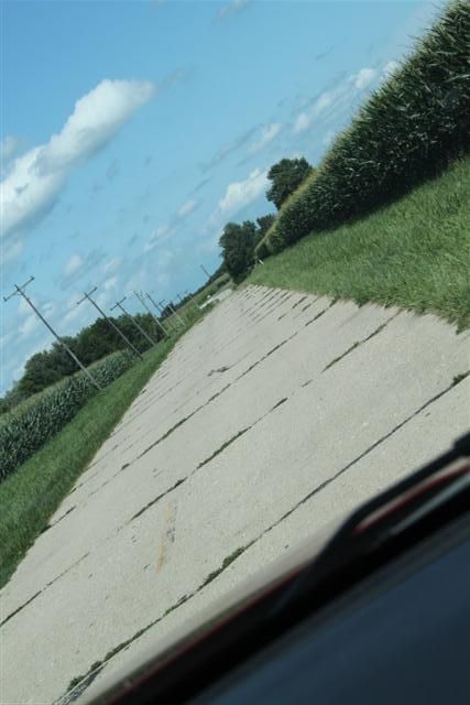
Since we didn't actually have a proper map and no satnav, these were a lifesaver and pretty much made our journey possible. We'd tried to get a PAYG SIM for the iPad but it seemed to be impossible to buy one from anyone like AT&T without a US zip code. Walgreens sell pre-paid cards but you need a mobile phone to validate it and we had dad's phone which is not unlocked and my unlocked Nokia 3310 which doesn't work in the USA! We basically relied on a very vague guide sheet that I'd printed out and these signs! I mentioned above that R66 takes a number of routes depending on the age of the road. The brown signs give you datestamps for the bit of road that you're about to follow and we opted to stick with the 1926-1930 or 1930-1940 route where we could. Through the state of Illinois, most of the later version of the R66 road is either underneath or runs alongside what is now the Interstate 55, a 5 lane motorway, so you can blat 300 miles along there and see nothing. Earlier bits take diversions to bits of road infrastructure that were already there to speed up the build of the original road.
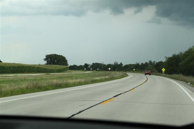
We got our first taste of this just outside a town called Gillespie. Where the road is not a motorway, Interstate 4 has replaced Route 66. This is just like one of our NSL roads and you just have to keep your eyes open for the brown signs that take you off on a diversion. We'd been hoping that we might find a tiny bit of abandoned original R66 road during the road trip and as we were heading along at 60-ish we spotted a sign pointing off the road down a track. With no-one behind us, we slammed on the brakes, span round and headed back. And it was totally worth it. Check it out:
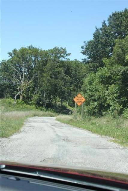
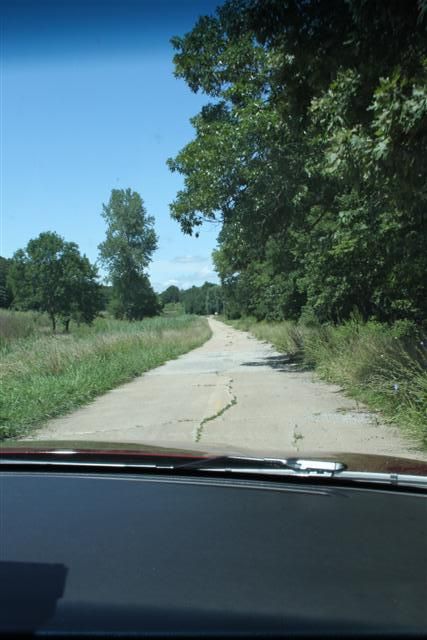
This was it! Exactly the same busted up surface as at the Chain of Rocks bridge, road closed, dangerous bridge sign and a faded unattended road block! This was the abandoned bridge:
We quickly recognised that those yellow lines in the road signified that you were on a much older section of road surface. They stopped using yellow lines some years ago, so seeing them meant you were on a surface that hadn't been re-laid for 30-40 years.
From there we continued to Carlinville on the old road which is several miles west of I55 and snakes around somewhat compared to I55 which is much straighter. We gassed up there at $3.69/gal and took some pics including the gothic revival jailhouse that was used from 1869 to 1988 and the Million Dollar courthouse:
I also spotted this old Googie sign hanging on the outside of a mobile phone shop:
North of Carlinville, the signs take you off Route 4 and onto a narrow original part of Route 66 several miles long that runs through Nilwood. There is a section where the road is full of turkey footprints that are apparently still visible, but we didn't spot them. This is what we did see:
Out of Nilwood and you pop back onto R4:
Then is Thayer where R66 runs takes a diversion through a very residential area before going back onto R4. Back in the day this would have been solid traffic and you wouldn't be able to walk across the road here. Amazing:
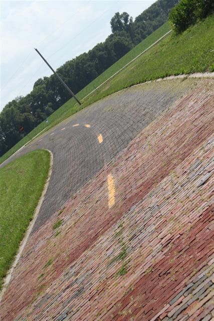
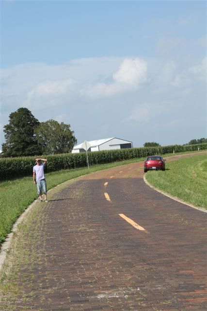
The first of the big 'attractions' on the Illinois part of R66 is the brick road. When Route 66 was first built it took a diversion to use an existing stretch of road that had been built in Portland brick in 1921. R66 was relocated to the side of the brick road in 1930 and the brick road abandoned in 1932. Because it has historical significance as an example of early highway building, it has been partially restored so it can be visited and driven on and there's over a mile of it. We found that there was a section that was used by quite a lot of through traffic that appeared to be quite new brick that ran through a residential area, then the road took a fork and the original Route 66 surface was quite obvious. This is entering the newer section:
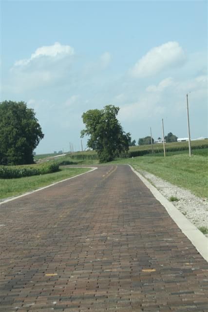
And this is the original bit which none of the traffic was using:
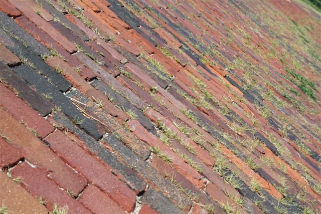
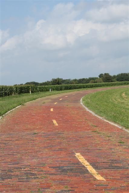
Here you can see where the new bit ends and the old bit starts, plus the fork in the road I mentioned:
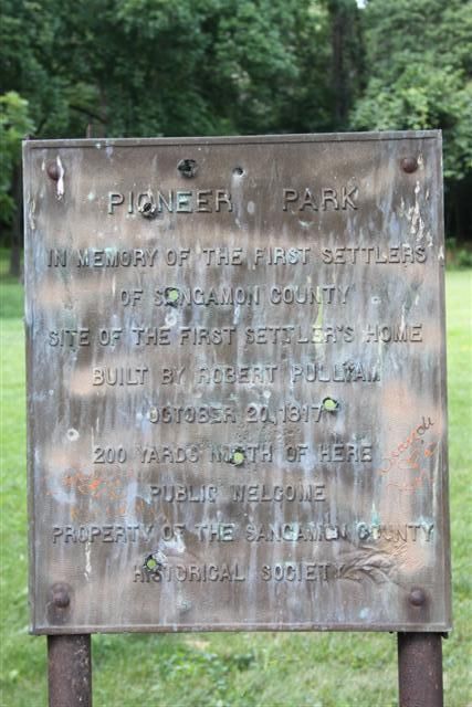
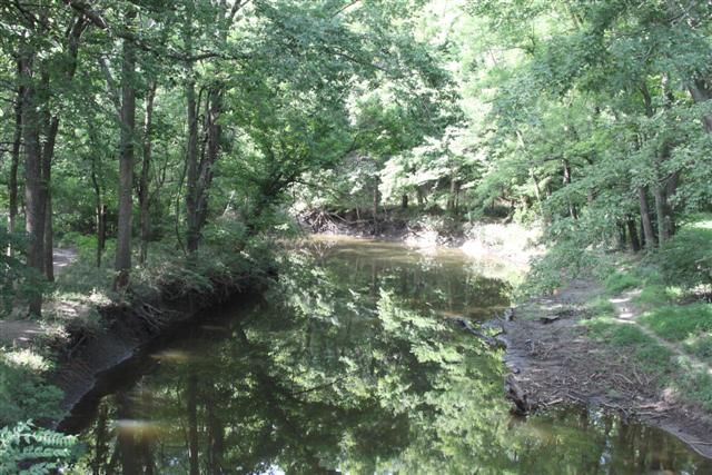
North of Auburn you can take a diversion away from Route 66 and visit Pioneer Park on Sugar Creek which has an original Covered wooden bridge built in the 1880's. It's really peaceful there and I loved the sign full of bullet holes:
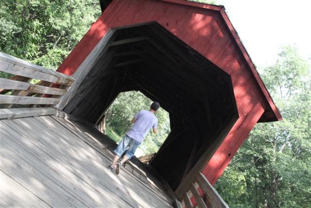
The bridge crosses Sugar Creek:
From there, there wasn't much more to see until we got to Springfield, capital city of Illinois, where we planned to get a motel, and R4 led us straight in. We'd covered about 120 miles in total and were therefore on target to do all 300 miles back up to Chicago in 2 days.
Spotted a donk on the way in:
Wednesday 7th August:
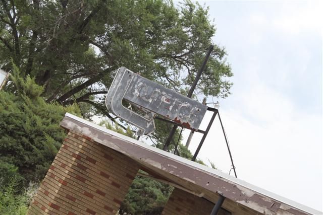
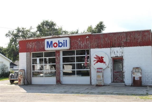
There's a lot to do in Springfield and we didn't have a lot of time so we had to cherry pick a couple of things and move on. First up was Shea's gas station on the side of R66 as it runs through the middle of Springfield. Old man Bill Shea ran the gas station back in the day and when he closed up spent more recent years (in his 90's) running it as a museum and collecting and displaying disused Route 66 memorabilia. It was closed when we were there but we got some pics through the fence:
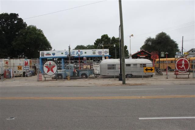
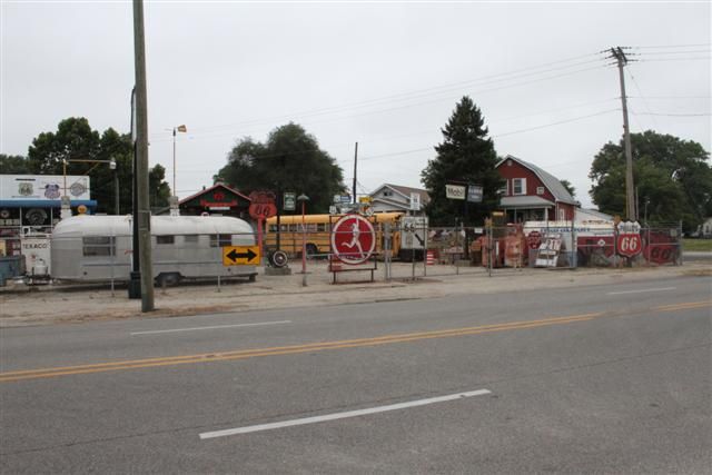
I was sad to see that Bill Shea died on 14th December 2013 aged 91. We must have just missed him, so RIP Bill and thanks for the gas station.
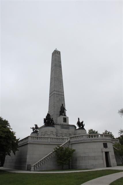
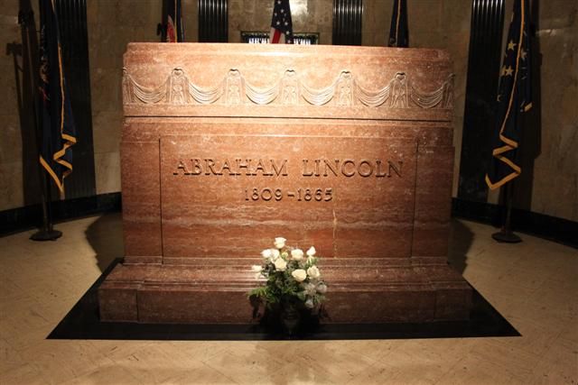
Lincoln's tomb is in Springfield, as is the Illinois State Capitol Building:
Looking up inside the State Capitol:
This guy was mentioned in Blues Brothers, can't remember who he is:
Another tangent of this road trip was I wanted to visit a couple of diners featured in Man Vs Food and there was an episode in Springfield featuring the Cozy Dog diner where the corndog was invented and Joe Roger's Chili Parlor where Adam Richman takes on the Firebrand Chili Challenge. I only had to spend the next 2 days sat in a car with a bowl of red hot chili bubbling away in my gut - what could possibly go wrong?
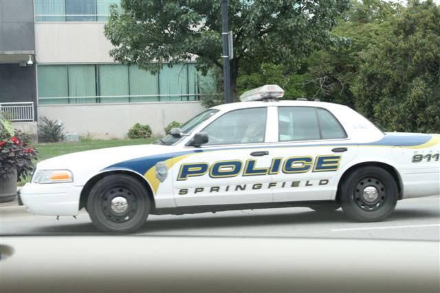
I FOUND CHIEF WIGGUM!
Just outside Springfield we could see small sections of overgrown older Route 66 running parallel with I55 North and at times it appeared to run in the middle of the two multiple-lane directions of I55. It was inaccessible due to the road but we managed to peel off I55 onto a newer part of Route 66 which was being still being used to the east side of I55. So here we're on 1940-1977 Route 66, you can see abandoned 1926-1930 Route 66 on the left and behind the trees is I55
As we left springfield still on R66, we were still running parallel with I55 somewhere near Elkhart:
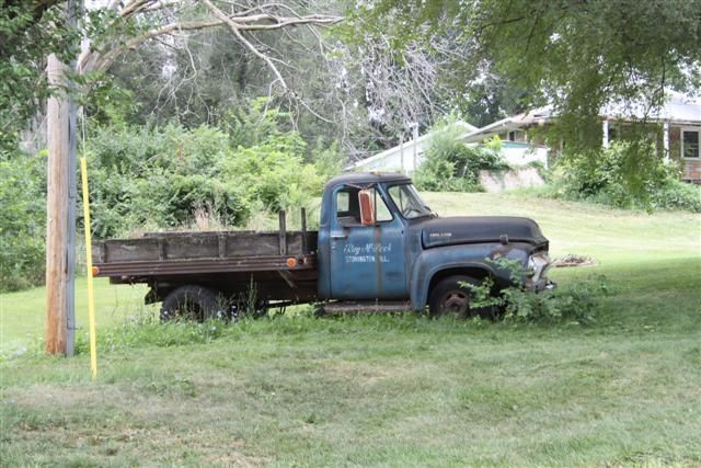
At Lincoln we wanted to take a diversion so see Salt Creek. We didn't actually find it because we got lost and drifted onto someone's land, typical sort of place with 'No trespassing or you'll be shot' signs. There were some cool abandoned trucks:
The next town along is Atlanta where Route 66 takes a fairly sharp diversion off. Atlanta was a classic example of a town that flourished and grew when Route 66 was built, but a 1940-1977 rebuild of the road bypassed the town and it slowly died due to no through traffic. Today it is very quiet but the sections of old Route 66 have been preserved and some attractions put up to draw in some R66 tourism. Of note is [url=http://www.atlantaillinois.org/rt66/bunyon_popup_new.html[/url]Bunyon's Giant[/url], a huge fibreglass giant holding a hotdog:
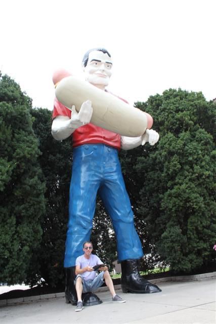
He was originally at a diner somewhere on R66 in Arizona in the 1960's, but when the diner closed and the statue was to be destroyed, Atlanta decided to save it. When he was first built, he'd have been carrying an axe.
Looking back to Atlanta, this is 1920's/1930's Route 66 surface:
The road runs into the trees behind the photo and as you join back onto the later Route 66 you can see it would have flowed smoothly back onto the route before it was bypassed.
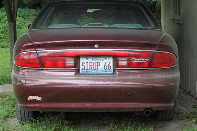
The next 'must visit' along the route is Funk's Grove where the Funk family make maple sirup from the maple trees growing in the forest. If you visit in February they are busy tapping the trees and making sirup, but by August they just have the shop open to buy the stuff. And it's delicious!
Somewhere between Normal and Towanda we lost the route somehow and had to rely on the compass in the car to go in roughly the right direction. Eventually we crossed I55 so we knew we were nearly back on track and we spotted a road surface heading in the right direction that looked like it should be 66. That part of the road ran parallel with a very old, very overgrown surface on our left and there were a few crossing points which allowed us to stop just as some heavy rain broke. I'll let the pics do the talking, but in the first one you can see an old stone bridge with the old '26 road and we're on the later surface next to it:
This was just what we were looking for. So awesome! Further up the road the original road was completely overgrown and you couldn't see it at all.
North of Atlanta is Pontiac. It's not related to Pontiac cars but they have put in a Pontiac car museum with models from the 30's, race cars, a bit of muscle and some farmyard machinery. There is also an excellent free to enter Route 66 museum well worth a visit with some short movies about the team who helped preserve and re-open the closed sections of Route 66 that we were driving on. There is also a Hungarian bakery called Pfaff's that we wandered into to get a coffee and a cake and they do some fantastic apple fritters. Go there if you go there!
4:30pm: I got my first rumblings from the Firebrand chili, while walking around the Pontiac museum.
Dwight is next on the map and has a couple of restored gas stations to visit:
Someone's front garden:
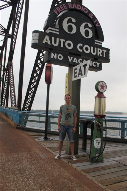
The main attraction is the Texaco garage which was open until quite recently and was restored as a tribute to Route 66. Even the bell rings if you step on the line:
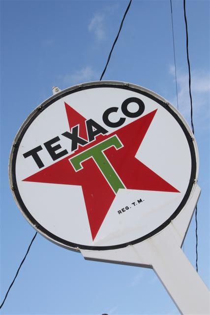
This was the most awesome thing to see at the Texaco garage:
And some more relics and chod in Dwight:
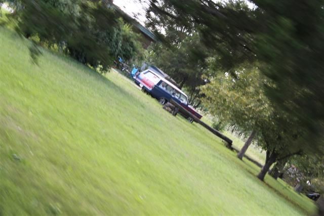
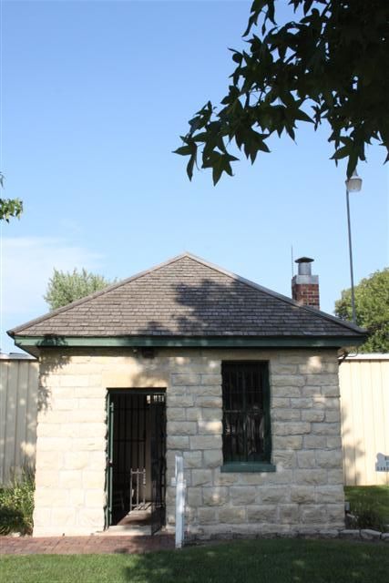
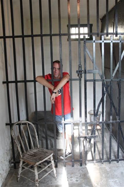
Gardner then has a tiny historic 2-cell jail dating back to 1906 and used until 1950, and a Kankakee streetcar used as a diner in Gardner from 1932:
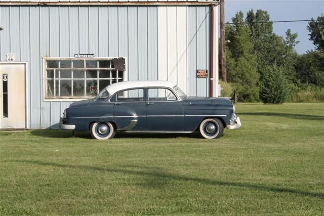
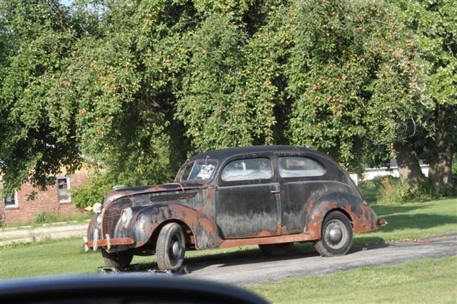
I spotted these two old cars in Braceville:
There's another fibreglass giant in Wilmington but we were only driving through there and I didn't get a photo.
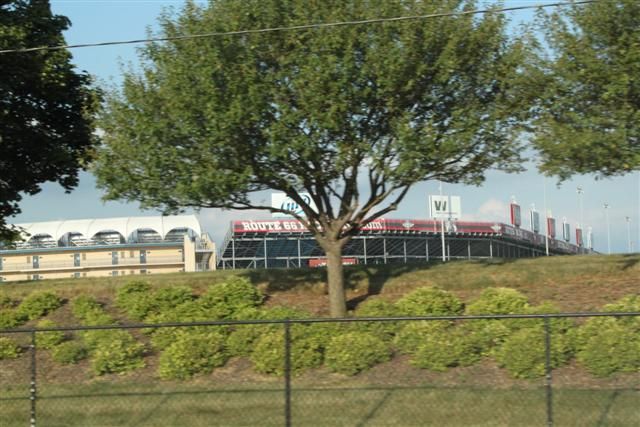
Another tangent of our road trip is Illinois is Blues Brothers country and we wanted to see about taking in as much Blues Brothers as we could. Elwood is a town just off Route 66 but it turned out that there was nothing to see there apart from the Route 66 Raceway just north:
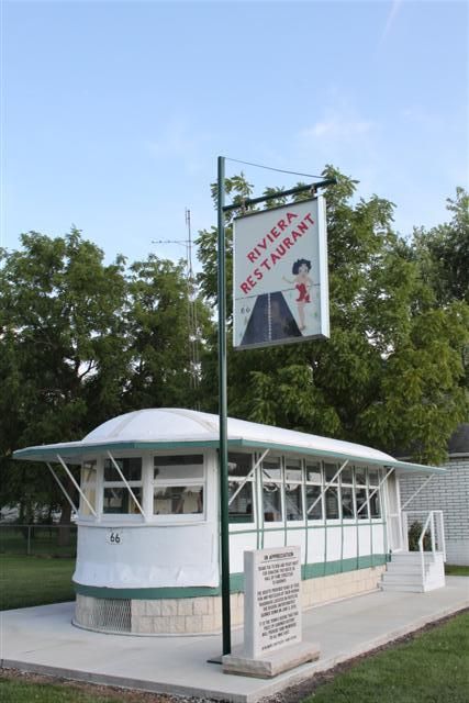
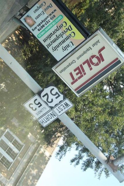
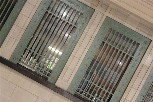
Joliet was next and we really wanted to see the Joliet State Correctional Facility, now known as Collins Street Prison. Joliet is quite sprawled out and without a map we didn't stand a chance. It's quite a run down area and industrial. We stopped off and had a look in Main Street Station and spotted a Blues Brothers themed diner on the way out:
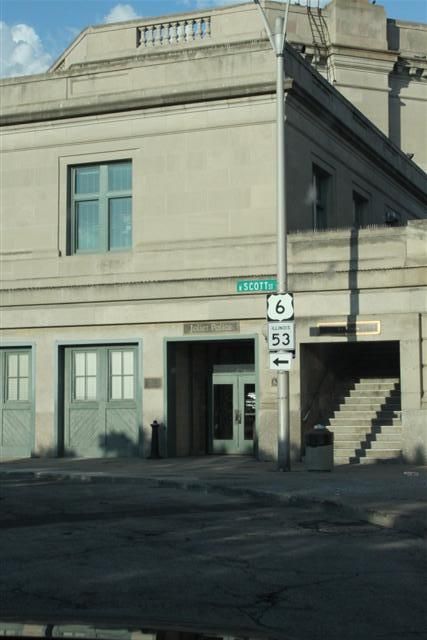
In the station:
Is this THE bridge?
Probably not, there are loads of them around there.
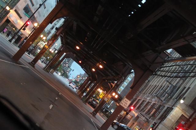
And that was pretty much the end of our time on the old part of Route 66. We had no idea at which point it was 106 miles to Chicago, but after that road out of Joliet we went through Bollingbrook and had no further options to stay on Route 66. As the area became more built up and we got nearer to Chicago we had an option to go on R355 into the suburbs and get completely lost or to switch to I55. We had planned to find a Route 66 diner that was listed on our route sheet right in Chicago and followed a brown sign off I55 at exit 276C, but it turned into a minefield of roads and it was starting to get late and dark. The road that we were on took an interesting diversion and as it cut back through I looked back and spotted an old broken bit of tarmac a couple of hundred metres long, an old road that ran between some building, closed at each end and running in the right direction. I have no doubt that it was the final section of Route 66 that I would see on my roadtrip. We followed the signs back onto I55 and I conclude my write-up under the railroad where so many cop cars may have been wrecked in Blues Brothers. Hope you enjoyed the read!
We decided early on because of the mileage we'd be covering that we should have a sensible car, so no mad Mustangs to report unfortunately. We got a brand new Ford Taurus with 3 litre V6 but I tell you it shifted that barge quite effectively and returned us an amazing 30 mpg in US gallons. The boot was enormous. Here's me in it having my suitcase passed to me:
Nah, only joking. I don't always look that silly

Monday 5th August:
So we started our journey in Louisville, Kentucky. It's the largest city in Kentucky and situated on the Ohio River. It's famous for Abe Lincoln and the Slugger Field, plus of course the Kentucky Derby which takes place where the Nationals were held.
From Louisville we drove pretty much due west across to St Louis in Missouri where we could pick up where the old Route 66 road left the state of Illinois and we'd follow it 'backwards' through Illinois up to Chicago. I say backwards, because the road was built from East to West to take people from the poverty stricken East to the more prosperous West of the US. Along the way we spotted a sign to Santa Claus - it didn't matter how far away that place was - it had to be visited

Woohoo!
It turned out to be a whole town that was devoted to the Santa Claus theme park and Holiday World. Hey kids, we're HERE!
At St. Louis, we visited and went up the Gateway Arch, a 192 metre welded stainless steel arch that marks the gateway to the West.
This is very close to where the old Route 66 road crosses the Mississippi river so the main focus of our roadtrip was about to begin and we were excited. Having climbed the arch we had a very basic map to find Route 66. We were looking for the Chain of Rocks Bridge which is an abandoned steel road bridge that was built in 1929 and crosses the Mississippi linking Missouri with Illinois. Taking the main road close to the river and heading north, which was correct, we soon found ourselves heading in the wrong direction and exactly where we DIDN'T want to be: we ended up a long way into an all-black neighbourhood. I never appreciated how segregated America is until quite recently, but blacks and whites still live very much apart and there are still huge social differences between 'white' and 'black' areas. Black areas being very poor and run-down and bordering white areas being affluent. The whole area was falling down and I was later told that many of these buildings that appeared to be abandoned were in fact still inhabited by the poor. It was very distressing to see this and I can only blame the lack of any kind of social system to pick people up when they fall down.
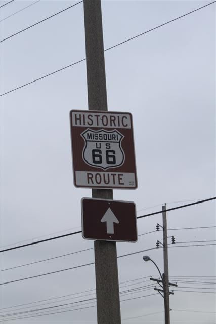
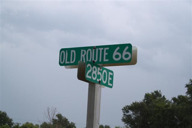
Essentially, we had been going in the right direction but drifted off course a bit, lost the river and gone too far. We turned around in the middle of a scene out of Boys in the Hood and headed back towards the water. Eventually we found a road that was on our map and we knew again where we were and headed that way. And this is what we found. First this:
THEN THIS!
We'd made it, WE WERE ACTUALLY ON ROUTE 66!!!
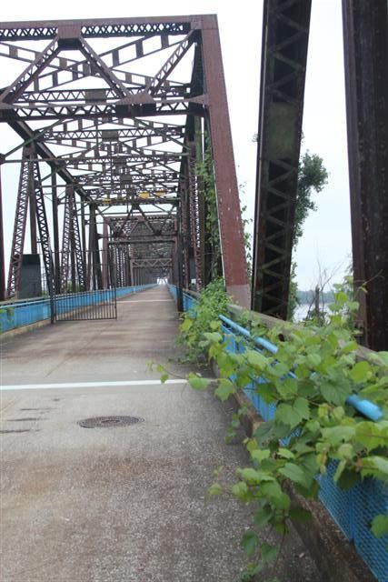
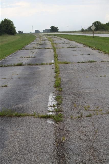
This part of the road was actually just part of the normal roads and had been built over so it wasn't very exciting but we were both whooping and the excitement was brewing. The bit we were looking for was a mile or so ahead and, although we knew it was an abandoned bridge, we didn't really know what we were looking for. There was no question when we got there:
Read more about the bridge here, but essentially the Chain of Rocks Bridge was built in 1929 for Route 66 traffic to cross the Mississippi. It's 1.6 miles long with a bend in the middle and was officially closed in 1970. It remained abandoned for many years until the late 90's when a trail group renovated the path and re-opened it for foot and cycle traffic, so today you can walk across the bridge. It's still very much crusty and unrestored, there's hardly anyone there, very quiet as you approach it and you have to watch your feet in places. It's awesome!
Nearer the middle, some Route 66 regalia has been placed there:
It pretty much all looked like genuine stuff and it felt good to be there. Not overdone. Further along as we walked around the bend, we were surprised to see this in the distance:
Couldn't see what it was at first but it looked like a 30's car:
It's a 30's fire truck left as a monument. Some might see it as a waste left there to rot and get vandalised, but it was pretty much limited to names and messages in the paint. I thought it was great:
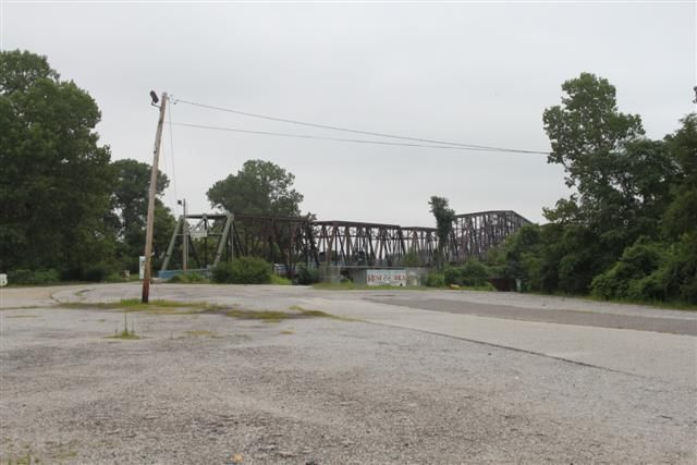
It was getting on a bit and we needed to get to the Illinois side of the river to find a motel for the night. Because Chain of Rocks is not open to vehicles, we had to drive along the river and pick up 270 to use the new bridge. It's not far down and here is Chain of Rocks from the side:
Ideally we wanted a motel somewhere near R66. Our guide sheet said it was run down in that area but nothing could have prepared us for what we found. We were in an area called Granite City which, when R66 was built, began to prosper. As R66 was abandoned and closed, many of the towns along it began to perish and Granite City was one of them. Today it is nothing more than a truck stop with a few diners, but the relics of R66's heyday are still there: huge numbers of old signs next to the road and abandoned motels. Or that's what we thought. Turns out most of these places have people living in them and are still open - not that they see a lot of passing trade. We decided to check one out. As we went in it was 100% Cohen Brothers film. Crusty smashed out Googie 'Motel' sign, some residents sitting on wooden chairs outside motel rooms, a small child playing with a ball in the stones, a thin looking dog barking, a slight breeze, a kitten ran out of nowhere and disappeared. I jest ye not, this happened! So we asked one of the people if there was a room free and they said they'd get the owner. He could have just walked round and talked to us in the open, but he made us go in and talk through the window, which was a curved top window with a hole in it in a small hatch. He pulled a blind up and spoke to us through the hole!
They were full and it was getting dark so we tried the next one across the crossroads. They had a room for $48 so we checked in and asked one of the residents where we could get some food. There were 6 residents outside and a young girl doing here homework. The whole place was completely run down, but the inside of the room was actually pretty nice, it was clean and had a good shower. We ended up at Hardees, a local burger diner. So I ought to point out that we couldn't look any more conspicuous. Two Brits in a brand new car in a rund down part of town where nobody ever visits because the R66 advice says stay away from the place. When we ordered in Hardees they could tell immediately and asked where we were from. When I said we were from London the girl replied "LONDON? What the F*** are you doin' in Granite City?" which was hilarious. On the way back we stopped at the Mart to get some beers in the hope that we might spend some time talking to the motel residents. Of all the beers they could keep, we found Newcastle Brown Ale and it was a damn sight cheaper than it is over here - $7.99 for 6! So we scooped up a crate to share. So the first guy John, he was an ex felon and out of work but doing cash-in-hand work to pay the motel rent. He lived with his girlfriend and 11 year old son in the motel room. She asked us if we smoked marijuana. There was another guy who had 3 dogs, peagles he called them, half pitbull / half beagle and they were great. I was telling the kid all about England, he said he wanted to be a police officer when he grew up and I gave him a £1 coin as a souvenir. Late in the evening we were speaking to a big guy who worked at a car dismantler and we were comparing scrappage laws. He said that John and his girlfriend met a few weeks ago in a mental asylum.
Tuesday 6th August:
Early the next morning we got breakfast at the local Waffle House and took some pics of the motel:
We got talking to the owner of the motel, Nick Patel, who brought out an old aerial shot of the motel which showed it when it was still complete:
Much of the building has been removed now due to planning laws and general lack of business. Another factor that led to the local demise was a change in alcohol licensing laws to try to clean the place up, so the motel can no longer have a bar and the local bars and nightclubs closed as a result. He paid $225k for it a couple of years ago and is hoping a local casino firm will get planning permission to build a casino on the site which will bring huge amounts of money back to the area. It's quite likely, so these sorts of motels will not be there for much longer. If you get the chance to go there, it's the Canal Motel on the Chain of Rocks Road, Granite City, Illinois. Chain of Rocks Road is actually Route 66.
We wanted to see the Chain of Rocks from the Illinois side and make it the beginning of our journey, so we took a drive down the road to it. On the Missouri side of the bridge there was an old busted up road surface leading up to the bridge which I commented that it looked like it might be original. This was a similar surface and led directly to the bridge so we were fairly confident we were now driving on an original Route 66 surface:
The bridge runs through some forestry, it's a bit more crusty and it's a lot quieter on this side because it's not near a main road, so the abandoned feel about it is much stronger:
We could see on our guide sheet that Route 66 wasn't just one road. The original road picked up many existing towns and road features like existing bridges and it was rebuilt several times in the period between 1926 and 1977 with bypasses and new towns. It therefore took a number of different routes over the years. The guide sheet told us to head off slightly east and pick up the 270 road again and drive on for a number of miles to pick up R66. Clearly, the original road wouldn't have done this because we were standing on it and it would have just gone straight, so we opted to go that way. We passed the motel, an abandoned liquor store and the first of what we'd see of various buildings with old signs still hanging out the front:
We continued for quite some distance before we picked up a place called Edwardsville that was on the guide sheet and eventually a place called Hamel where Weezy's was listed as an original Route 66 diner. We stopped off for a couple of coffees and a sandwich before heading on:
Now we were starting to see more of the brown Historic Route 66 signs that are dotted along the route:
Since we didn't actually have a proper map and no satnav, these were a lifesaver and pretty much made our journey possible. We'd tried to get a PAYG SIM for the iPad but it seemed to be impossible to buy one from anyone like AT&T without a US zip code. Walgreens sell pre-paid cards but you need a mobile phone to validate it and we had dad's phone which is not unlocked and my unlocked Nokia 3310 which doesn't work in the USA! We basically relied on a very vague guide sheet that I'd printed out and these signs! I mentioned above that R66 takes a number of routes depending on the age of the road. The brown signs give you datestamps for the bit of road that you're about to follow and we opted to stick with the 1926-1930 or 1930-1940 route where we could. Through the state of Illinois, most of the later version of the R66 road is either underneath or runs alongside what is now the Interstate 55, a 5 lane motorway, so you can blat 300 miles along there and see nothing. Earlier bits take diversions to bits of road infrastructure that were already there to speed up the build of the original road.
We got our first taste of this just outside a town called Gillespie. Where the road is not a motorway, Interstate 4 has replaced Route 66. This is just like one of our NSL roads and you just have to keep your eyes open for the brown signs that take you off on a diversion. We'd been hoping that we might find a tiny bit of abandoned original R66 road during the road trip and as we were heading along at 60-ish we spotted a sign pointing off the road down a track. With no-one behind us, we slammed on the brakes, span round and headed back. And it was totally worth it. Check it out:
This was it! Exactly the same busted up surface as at the Chain of Rocks bridge, road closed, dangerous bridge sign and a faded unattended road block! This was the abandoned bridge:
We quickly recognised that those yellow lines in the road signified that you were on a much older section of road surface. They stopped using yellow lines some years ago, so seeing them meant you were on a surface that hadn't been re-laid for 30-40 years.
From there we continued to Carlinville on the old road which is several miles west of I55 and snakes around somewhat compared to I55 which is much straighter. We gassed up there at $3.69/gal and took some pics including the gothic revival jailhouse that was used from 1869 to 1988 and the Million Dollar courthouse:
I also spotted this old Googie sign hanging on the outside of a mobile phone shop:
North of Carlinville, the signs take you off Route 4 and onto a narrow original part of Route 66 several miles long that runs through Nilwood. There is a section where the road is full of turkey footprints that are apparently still visible, but we didn't spot them. This is what we did see:
Out of Nilwood and you pop back onto R4:
Then is Thayer where R66 runs takes a diversion through a very residential area before going back onto R4. Back in the day this would have been solid traffic and you wouldn't be able to walk across the road here. Amazing:
The first of the big 'attractions' on the Illinois part of R66 is the brick road. When Route 66 was first built it took a diversion to use an existing stretch of road that had been built in Portland brick in 1921. R66 was relocated to the side of the brick road in 1930 and the brick road abandoned in 1932. Because it has historical significance as an example of early highway building, it has been partially restored so it can be visited and driven on and there's over a mile of it. We found that there was a section that was used by quite a lot of through traffic that appeared to be quite new brick that ran through a residential area, then the road took a fork and the original Route 66 surface was quite obvious. This is entering the newer section:
And this is the original bit which none of the traffic was using:
Here you can see where the new bit ends and the old bit starts, plus the fork in the road I mentioned:
North of Auburn you can take a diversion away from Route 66 and visit Pioneer Park on Sugar Creek which has an original Covered wooden bridge built in the 1880's. It's really peaceful there and I loved the sign full of bullet holes:
The bridge crosses Sugar Creek:
From there, there wasn't much more to see until we got to Springfield, capital city of Illinois, where we planned to get a motel, and R4 led us straight in. We'd covered about 120 miles in total and were therefore on target to do all 300 miles back up to Chicago in 2 days.
Spotted a donk on the way in:
Wednesday 7th August:
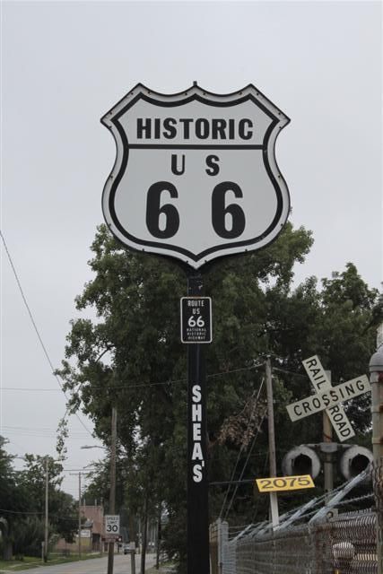
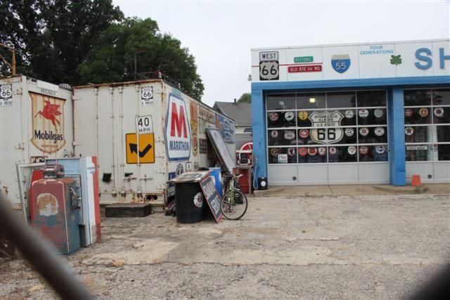
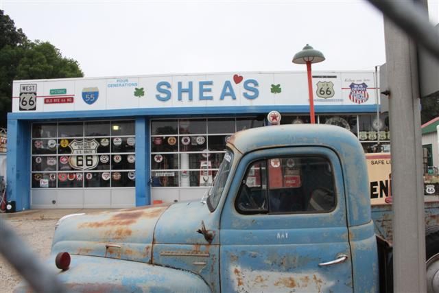
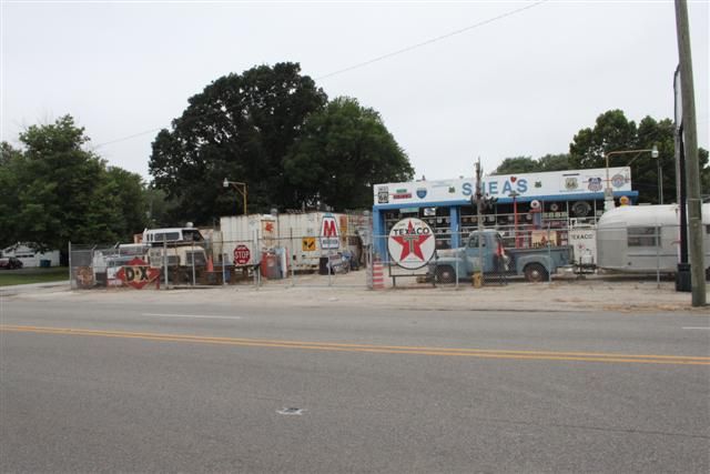
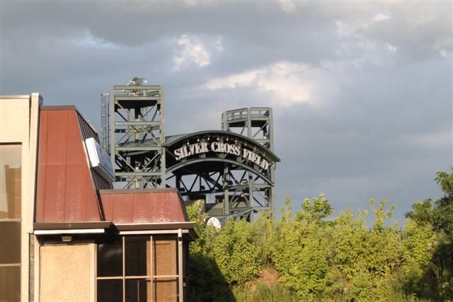
There's a lot to do in Springfield and we didn't have a lot of time so we had to cherry pick a couple of things and move on. First up was Shea's gas station on the side of R66 as it runs through the middle of Springfield. Old man Bill Shea ran the gas station back in the day and when he closed up spent more recent years (in his 90's) running it as a museum and collecting and displaying disused Route 66 memorabilia. It was closed when we were there but we got some pics through the fence:
I was sad to see that Bill Shea died on 14th December 2013 aged 91. We must have just missed him, so RIP Bill and thanks for the gas station.
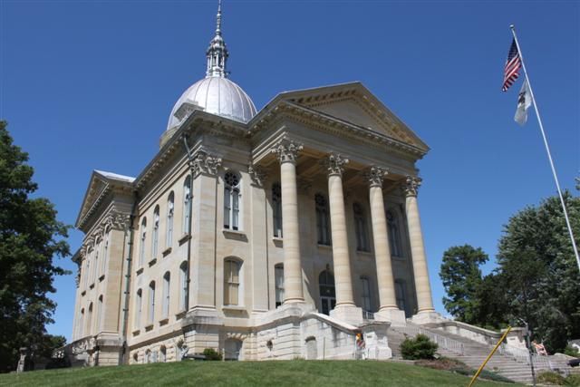
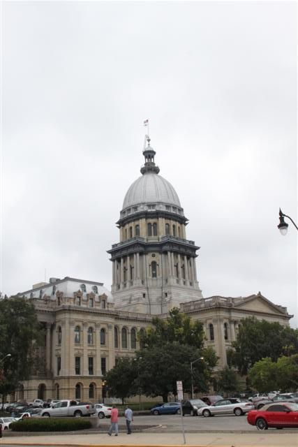
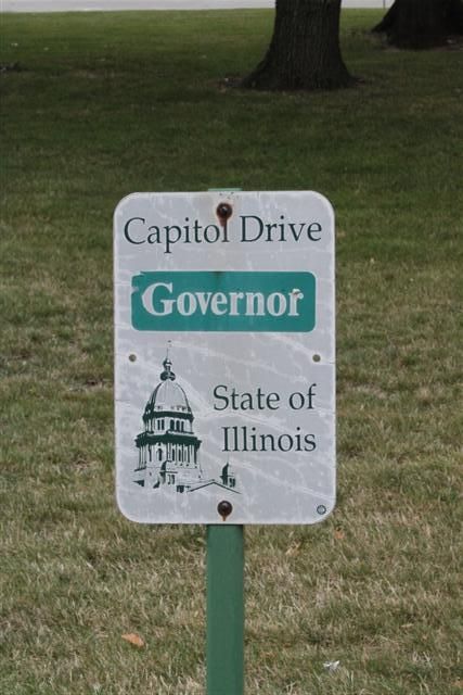
Lincoln's tomb is in Springfield, as is the Illinois State Capitol Building:
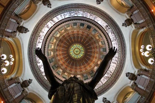
Looking up inside the State Capitol:
This guy was mentioned in Blues Brothers, can't remember who he is:
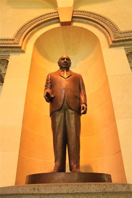
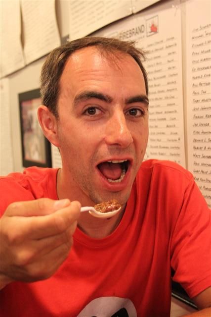
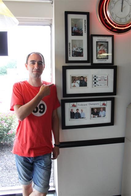
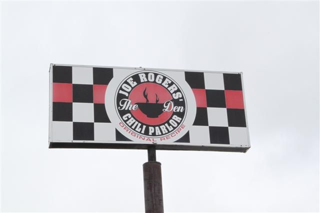
Another tangent of this road trip was I wanted to visit a couple of diners featured in Man Vs Food and there was an episode in Springfield featuring the Cozy Dog diner where the corndog was invented and Joe Roger's Chili Parlor where Adam Richman takes on the Firebrand Chili Challenge. I only had to spend the next 2 days sat in a car with a bowl of red hot chili bubbling away in my gut - what could possibly go wrong?
I FOUND CHIEF WIGGUM!
Just outside Springfield we could see small sections of overgrown older Route 66 running parallel with I55 North and at times it appeared to run in the middle of the two multiple-lane directions of I55. It was inaccessible due to the road but we managed to peel off I55 onto a newer part of Route 66 which was being still being used to the east side of I55. So here we're on 1940-1977 Route 66, you can see abandoned 1926-1930 Route 66 on the left and behind the trees is I55
As we left springfield still on R66, we were still running parallel with I55 somewhere near Elkhart:
At Lincoln we wanted to take a diversion so see Salt Creek. We didn't actually find it because we got lost and drifted onto someone's land, typical sort of place with 'No trespassing or you'll be shot' signs. There were some cool abandoned trucks:
The next town along is Atlanta where Route 66 takes a fairly sharp diversion off. Atlanta was a classic example of a town that flourished and grew when Route 66 was built, but a 1940-1977 rebuild of the road bypassed the town and it slowly died due to no through traffic. Today it is very quiet but the sections of old Route 66 have been preserved and some attractions put up to draw in some R66 tourism. Of note is [url=http://www.atlantaillinois.org/rt66/bunyon_popup_new.html[/url]Bunyon's Giant[/url], a huge fibreglass giant holding a hotdog:
He was originally at a diner somewhere on R66 in Arizona in the 1960's, but when the diner closed and the statue was to be destroyed, Atlanta decided to save it. When he was first built, he'd have been carrying an axe.
Looking back to Atlanta, this is 1920's/1930's Route 66 surface:
The road runs into the trees behind the photo and as you join back onto the later Route 66 you can see it would have flowed smoothly back onto the route before it was bypassed.
The next 'must visit' along the route is Funk's Grove where the Funk family make maple sirup from the maple trees growing in the forest. If you visit in February they are busy tapping the trees and making sirup, but by August they just have the shop open to buy the stuff. And it's delicious!
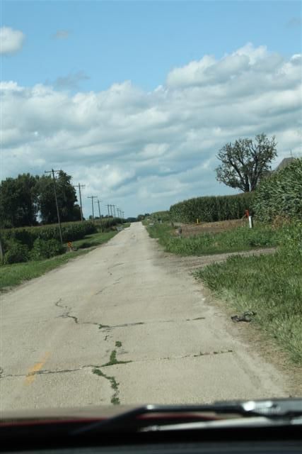
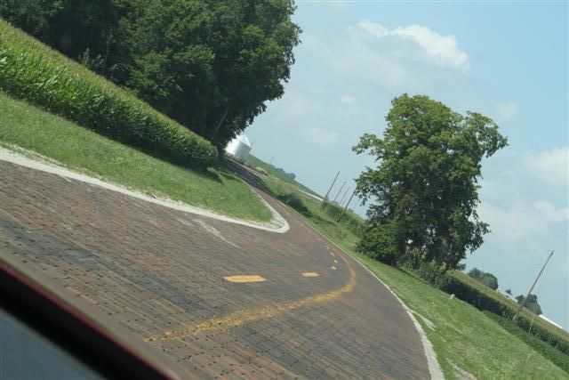
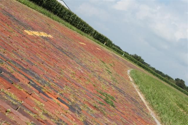
Somewhere between Normal and Towanda we lost the route somehow and had to rely on the compass in the car to go in roughly the right direction. Eventually we crossed I55 so we knew we were nearly back on track and we spotted a road surface heading in the right direction that looked like it should be 66. That part of the road ran parallel with a very old, very overgrown surface on our left and there were a few crossing points which allowed us to stop just as some heavy rain broke. I'll let the pics do the talking, but in the first one you can see an old stone bridge with the old '26 road and we're on the later surface next to it:
This was just what we were looking for. So awesome! Further up the road the original road was completely overgrown and you couldn't see it at all.
North of Atlanta is Pontiac. It's not related to Pontiac cars but they have put in a Pontiac car museum with models from the 30's, race cars, a bit of muscle and some farmyard machinery. There is also an excellent free to enter Route 66 museum well worth a visit with some short movies about the team who helped preserve and re-open the closed sections of Route 66 that we were driving on. There is also a Hungarian bakery called Pfaff's that we wandered into to get a coffee and a cake and they do some fantastic apple fritters. Go there if you go there!
4:30pm: I got my first rumblings from the Firebrand chili, while walking around the Pontiac museum.
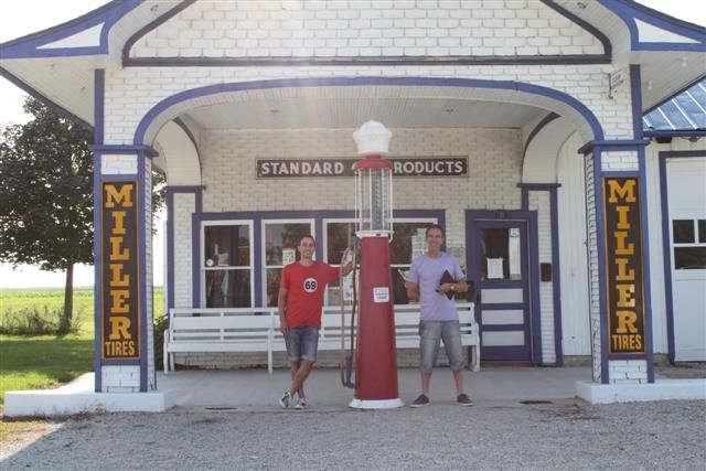
Dwight is next on the map and has a couple of restored gas stations to visit:
Someone's front garden:
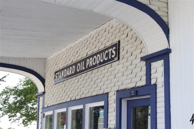
The main attraction is the Texaco garage which was open until quite recently and was restored as a tribute to Route 66. Even the bell rings if you step on the line:
This was the most awesome thing to see at the Texaco garage:
And some more relics and chod in Dwight:
Gardner then has a tiny historic 2-cell jail dating back to 1906 and used until 1950, and a Kankakee streetcar used as a diner in Gardner from 1932:
I spotted these two old cars in Braceville:
There's another fibreglass giant in Wilmington but we were only driving through there and I didn't get a photo.
Another tangent of our road trip is Illinois is Blues Brothers country and we wanted to see about taking in as much Blues Brothers as we could. Elwood is a town just off Route 66 but it turned out that there was nothing to see there apart from the Route 66 Raceway just north:
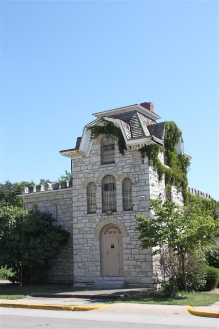
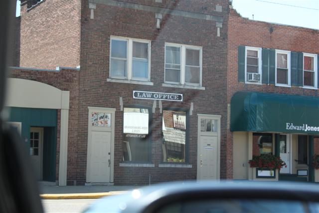
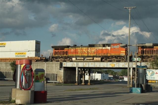
Joliet was next and we really wanted to see the Joliet State Correctional Facility, now known as Collins Street Prison. Joliet is quite sprawled out and without a map we didn't stand a chance. It's quite a run down area and industrial. We stopped off and had a look in Main Street Station and spotted a Blues Brothers themed diner on the way out:
In the station:
Is this THE bridge?
Probably not, there are loads of them around there.
And that was pretty much the end of our time on the old part of Route 66. We had no idea at which point it was 106 miles to Chicago, but after that road out of Joliet we went through Bollingbrook and had no further options to stay on Route 66. As the area became more built up and we got nearer to Chicago we had an option to go on R355 into the suburbs and get completely lost or to switch to I55. We had planned to find a Route 66 diner that was listed on our route sheet right in Chicago and followed a brown sign off I55 at exit 276C, but it turned into a minefield of roads and it was starting to get late and dark. The road that we were on took an interesting diversion and as it cut back through I looked back and spotted an old broken bit of tarmac a couple of hundred metres long, an old road that ran between some building, closed at each end and running in the right direction. I have no doubt that it was the final section of Route 66 that I would see on my roadtrip. We followed the signs back onto I55 and I conclude my write-up under the railroad where so many cop cars may have been wrecked in Blues Brothers. Hope you enjoyed the read!